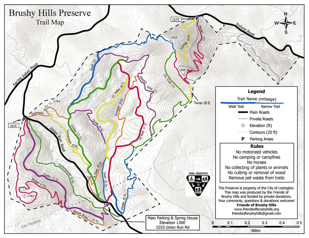
Trail Map
Please Stay on the Trails
to prevent erosion, damage to native plants, and the spread of invasive non-native plants.
Directions to Brushy Hills (from Lexington)
The address of the main trailhead and parking area is 1010 Union Run Road, Lexington, Virginia. Additional parking and trail access is available at 1371 Union Run Road and 1311 Enfield Road.
From the intersection of Nelson and Main Streets, take Nelson Street (Route 60) west. Turn left on Lee Street at the post office. At the end of the street, turn right on Preston Street and then left on Jackson Street. Follow Jackson Street and turn right on Ross Road. Follow Ross Road for about two miles to Union Run. Turn right on Union Run and follow for about a mile. Shortly after the road turns to gravel, the parking area for Brushy Hills will be on the left. There you'll find a kiosk and trail map, with printouts of the trail system.
Lexington, Virginia is located near the junction of highways 81 and 64 about an hour north of Roanoke, Virginia.